
Mono Lake, and all of us here at the Mono Lake Committee, have just been through the biggest winter on record. It is an abrupt and welcome end to drought conditions (though not to all the effects of the drought), made all the more enjoyable by the way it crept up unannounced and surprised us with its intensity.
Stories abound of Highway 395 being closed for days, snow blanketing every facet of the Sierra Nevada crest, and backcountry snowfields that measure taller than any building in Mono County. Speculation about an opening date for Tioga Pass—certain to be among the latest ever—is a popular springtime guessing game in town.
So what does it all mean for Mono Lake, its tributary streams, and the operation of the Los Angeles Aqueduct? Here’s the exciting outlook:
Mono Lake on the rise
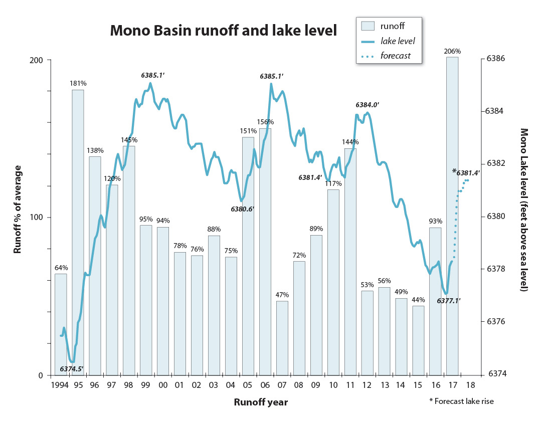
With a deep snowpack fueling runoff that is forecast at 206% of average, Mono Lake is expected to rise over three feet between April 2017 and March 2018. That is a lot of water, especially when you recall that Mono Lake is almost twice the size of San Francisco.
The lake typically rises a bit during winter; this year it rose an impressive 1.2 feet prior to April, largely due to precipitation on the lake and lower-elevation rainfall.
Still, California’s five-year drought caused Mono Lake to drop nearly seven feet, so while this will be an impressively fast recovery, it will not be complete: the forecast puts the lake on April 1, 2018 at an elevation of 6381.4 feet above sea level, still 2.6 feet below the lake level at the beginning of the drought.
Aqueduct exports limited
The Los Angeles Department of Water & Power (DWP) is allowed to export 4,500 acre feet of water this year in the aqueduct system. The relatively small allocation this year means that 98% of the big winter’s snowmelt will flow directly down the tributary streams to Mono Lake.
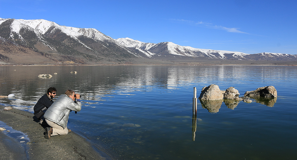
Export amounts are determined by the lake level as measured on April 1. Committee and DWP staff routinely read the official set of surveyed lake level gauges throughout the year. On April 1 we read them together due to the importance of that reading in determining exports. For example, had the drought continued and the lake dropped below 6377 feet, DWP exports would have been reduced to zero.
This year Committee staff met DWP representatives at the lakeshore early on the calm Saturday morning for the measurement. Conversation centered around the wet winter and the change on the lakeshore due to a level that was visibly higher than the prior year’s reading. The consensus reading was 6378.3 feet above sea level. A subsequent jointly-signed letter from the Committee and DWP reported the results to the State Water Resources Control Board.
Mono Lake enthusiasts have been asking a logical question: DWP may be allowed to export 4,500 acre feet of water, but does it really need to do so in this wet year? It is a good question, and the Committee has put it directly to DWP leaders. Why not just let the water flow down the creeks to the lake, where it has ecosystem benefits and, ultimately, helps DWP achieve higher lake levels that enable larger exports in the future? While DWP’s inclination is to follow past practice and proceed with water diversions, DWP leaders also realize that in this exceptional year Los Angeles is already slated to receive substantially more water than Angelinos use in a year. With the aqueduct already running full, Mono Basin exports can’t physically take place until late fall at the earliest; stay tuned for updates on this question.
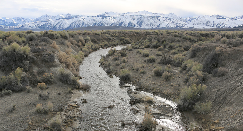
Rush and Lee Vining creeks running high
All of Mono Lake’s tributary streams will carry very high flows, hitting marks seen only once every 20 years. The State Water Board-appointed stream scientists who oversee restoration of the damage caused by past excessive water diversions in the aqueduct are excited. This is going to be a “wow year” according to stream scientist Dr. Bill Trush, who is expecting major structural stream processes to be activated by the force of the high flows. Pool scouring and channel shaping processes build habitat for fish and wildlife while overbank flooding, groundwater recharge, and seed dispersal benefit the recovery of the streamside forest.
Reservoirs on Lee Vining, Rush, and Mill creeks are expected to fill rapidly and spill water for many weeks, which helps achieve the high downstream flows needed for restoration. Although Rush Creek will be impressive, it will not achieve the high flow levels established in the 2013 Mono Basin Stream Restoration Agreement based on more than a decade of study. That’s because the new Grant Lake Reservoir outlet is not yet constructed. Once completed, the outlet will allow for large controlled releases in wet years to mimic natural conditions. Construction will begin after a final State Water Board order adopting the Agreement terms, which is expected this year.
Owens Valley awash
Visitors to the Owens Valley will be impressed to see water running in just about every historic ditch and filling every pond and percolating area. The Los Angeles Aqueduct has also been running brim-full since spring in anticipation of April–September runoff exceeding 200% of average in the Owens River watershed. Even so, significant volumes of water are still expected to make their way to the watershed’s natural endpoint at Owens Lake, expanding the remnant brine pool there to a much larger shallow lake. In March, Los Angeles Mayor Eric Garcetti declared a state of emergency in anticipation of the high flows and the damage that may be done to the extensive dust control facilities DWP has constructed on the bed of Owens Lake.
A big year for monitoring
Big flows and rapid lake rise are rare events. The Committee has increased our field monitoring to include more frequent documentation of streams, springs, and habitats at an expanded list of sites, such as ephemeral streams that do not flow in dry years. You can share in the excitement of this epic season by watching for updates here on the Mono-logue, and the next issue of the Mono Lake Newsletter will surely have some exciting runoff stories.
This post was also published as an article in the Summer 2017 Mono Lake Newsletter (pages 3 and 22).
[…] Original article […]