
This post was written by Lisa Cutting, 2002-2020 Eastern Sierra Policy Director, 2000-2001 Environmental Resource Coordinator, and 1999 Mono Lake Intern.
Type the word “monitoring” into the Mono Lake Committee’s website search bar and 673 results appear. To say that scientific monitoring and environmental advocacy work go hand in hand for the Committee is an understatement.
Ever since the Committee’s founders conducted the fundamental and pivotal ecological study of Mono Lake in 1976, scientific research and monitoring have been the basis for all of the work that has followed. In crafting policy positions, all aspects of an issue must be analyzed and understood, since arriving at a balanced solution often means that the ideal, perfect path forward isn’t always possible. Sometimes a compromise can be negotiated, sometimes not. Science and monitoring inform those decisions.
Why the Committee?
Why does the Committee do field monitoring? Isn’t that the responsibility of agencies like the Los Angeles Department of Water & Power (DWP) or the US Forest Service? The answer is both yes and no. Different agencies have different directives and most only do what is mandatory. Often the mandatory tasks aren’t enough because they represent individual pieces of a much larger puzzle. That’s why the Committee steps up.
The Committee looks at the whole Mono Basin—Mono Lake, the streams, and the surrounding lands—and how it functions as a complete system and therefore is always striving for the most comprehensive approach to protection and restoration. When information gaps arise the Committee musters the resources to help fill them. We are constantly pushing for the most comprehensive scientific exploration, the most relevant monitoring, and the most expert analysis of Mono Basin-specific information.
The Committee’s monitoring and scientific research also serve as a way to check to make sure that things like State Water Board flow requirements are being met. Issues such as equipment malfunctions, inconsistent sample processing, and quickly-changing conditions that need immediate monitoring have happened in the past, so having the Committee collect information helps augment the efforts of other agencies.
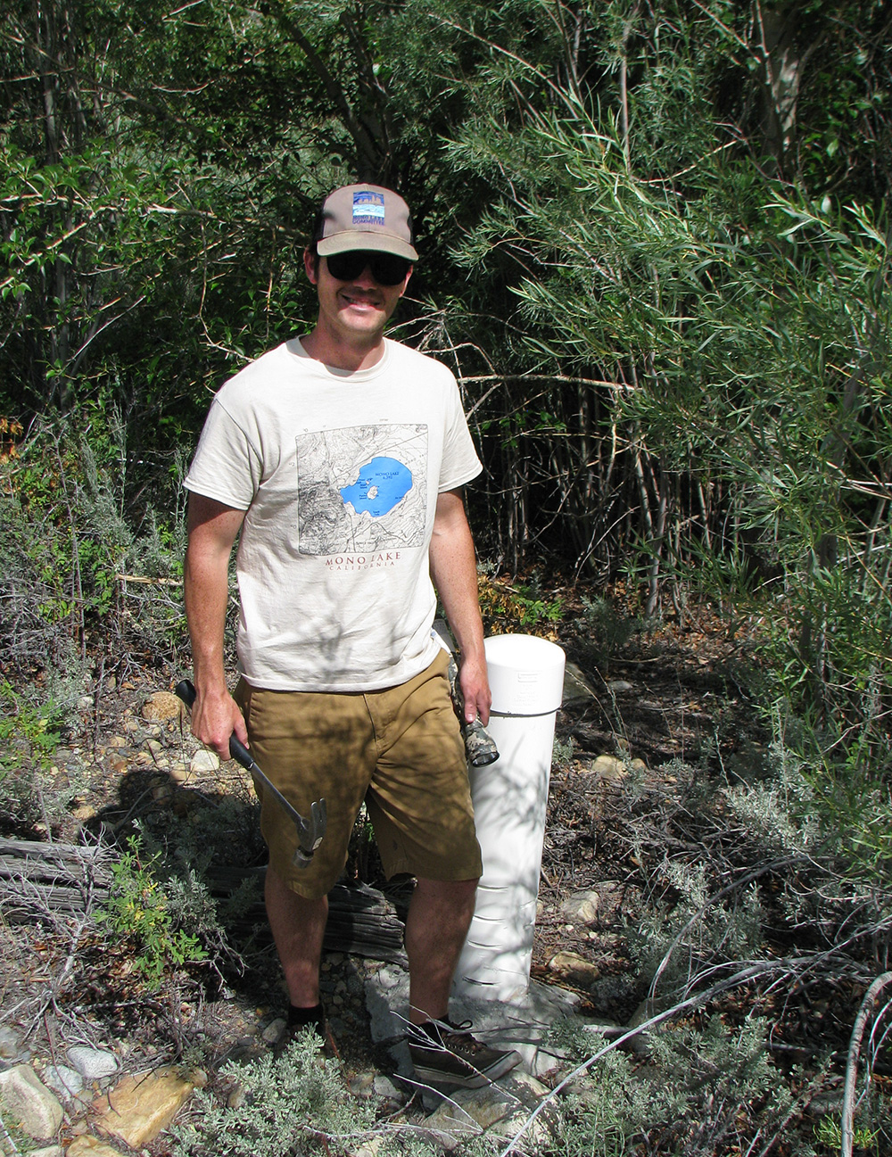
Plus, the Committee is the only organization or agency that has the staff resources to be at the lake or check a streamflow measurement within 15 minutes when necessary. Scientists often need Committee staff to field check an assumption or relay current conditions related to a study they’re working on. The Committee is happy to help and makes these activities a priority.
A sample of monitoring tasks
In the late 1970s monitoring was simpler. Is there water in the creeks? Is Mono Lake rising? How much? But now, 38 years later, Committee staff perform a wide variety of monitoring tasks year-round and have sophisticated equipment to get the most accurate information possible.
The Committee’s annual monitoring and scientific research support currently includes:
Mono Lake level: Since 1978, Committee staff have read the official lake level gauge. DWP staff also read the gauge. Having two independent readings ensures accuracy and helps prevent conflicts.
Migratory bird projects: Since its founding the Committee has supported annual California Gull rookery monitoring by either sending staff out to the islands to help field researchers or with funding when other sources diminished and threatened to end the long-term data collection—or both, as is the current situation. The Committee also leads the annual Eared Grebe aerial population survey by organizing pilots, photographers, and data collection, which is then sent on to experts in Canada for scientific analysis.
Streamflow and water diversions: The Committee receives a daily report from DWP with flow and water storage information for the entire aqueduct system and reviews hydrological information posted on DWP’s website. Any problems are investigated.
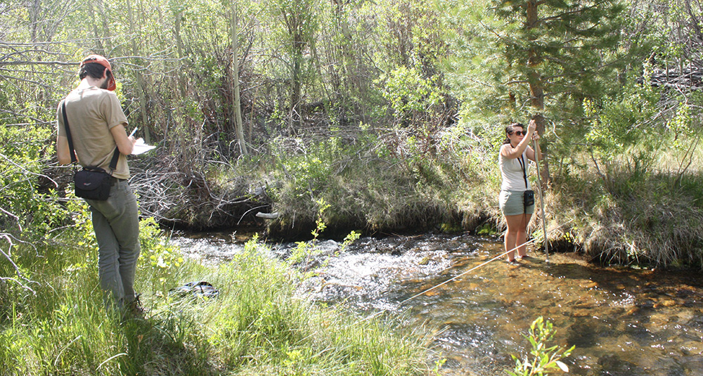
Rush and Lee Vining creek groundwater: Piezometers (tubes inserted deep into the ground near creek corridors) are used to read groundwater levels. These levels are important because they affect healthy vegetation growth, especially in the lower floodplain areas where the streams split into shallow channels. This monitoring began in 1995 and is conducted year-round, with more frequency in the summer months.
Mill Creek and associated diversions: Flow monitoring in the north part of the Mono Basin began in earnest in 1999, largely in response to excessive water diversions drying up Mill Creek before it reached Mono Lake. This has informed the Committee’s Mill Creek restoration advocacy work and contributes significantly to progress on improving the Lundy hydropower operation and irrigation efficiency to ensure that Mill Creek receives all the water to which it is legally entitled.
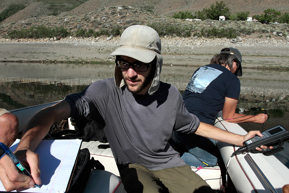
Grant Lake Reservoir: In response to the past four years of drought and low Grant Lake Reservoir levels, last year the Committee began monitoring water temperature and dissolved oxygen by boat in three locations every three weeks throughout the summer. The Committee wanted to help refine the theory that a low reservoir was warmer and responsible for adverse downstream effects on Rush Creek. Since a higher water temperature correlates with less dissolved oxygen, it affects aquatic life, most notably trout. Since Grant is still very low, this monitoring will continue this summer.
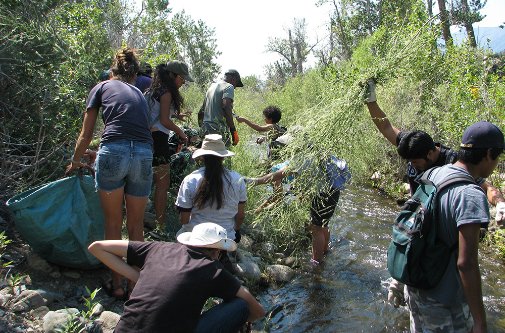
Invasive plant species: The Committee’s program of mapping key invasive plant species locations and removing the plants began in 1998 with a State Water Board restoration directive focused on tamarisk, and has since expanded. Degraded creek corridors remain a priority since disturbed habitats are vulnerable to invasive plant recruitment. The Committee works with local agencies to identify problem areas and Mono Lake Volunteers and Outdoor Education Center participants help with the field work.
Mono Basin Field Station: The Committee offers convenient low-cost housing for scientists while they conduct research in the Mono Basin. In 2003 the Committee identified this type of housing as a limiting factor for research in the Mono Basin, and the Mono Basin Field Station has hosted a wide variety of research projects since. The Committee benefits because that research is added to the collective knowledge of the Mono Basin and will ultimately inform future policy decisions. For example, this summer, Greater Sage Grouse researchers with the US Geological Survey are staying at the Field Station.
New monitoring for 2016
This summer the Committee is adding two additional monitoring tasks to assist the State Water Board-appointed stream scientists with their monitoring activities.
Stream temperature: Committee staff will place digital monitoring devices in the creeks to record water temperature throughout the summer. With Grant Lake Reservoir still below minimum recommended levels, continuous monitoring of in-stream temperatures is critical for informing management of the reservoir and the Rush Creek fishery.
Riparian vegetation growth rate: Staff will monitor cottonwood growth rates by measuring the distance from leaf nodes to stems throughout the summer. The data can then be correlated to streamflow and groundwater levels.
Monitoring key to adaptive management
In addition to informing policy positions, monitoring is critical to adaptive management, which the Mono Lake Committee has always embraced as the best way to achieve successful restoration. Adaptive management is an approach used to address uncertainty by viewing management actions as experiments derived from hypotheses, conducting extensive monitoring, evaluating the results, and then determining if the management and underlying assumptions need to be changed accordingly. By quantitatively tracking information related to specific management directives and actions, as well as the effects of those actions, management decisions can be reevaluated and adjusted to create even better outcomes.
The best example of this is the recent Mono Basin Stream Restoration Agreement that outlines new fine-tuned streamflows to provide the most ecological benefit. As a result of over ten years of monitoring and additional studies conducted to fill in the information gaps, the scientific data supported changing the streamflows that DWP is required to deliver throughout the year in a way that will significantly benefit the overall system without increasing the total amount of water needed. In this case, additional information has resulted in maximizing ecological health while still meeting the water needs of Los Angeles.
A lot has been learned from the Committee’s monitoring activities since the original studies from the 1970s. It’s reassuring to know that this summer’s monitoring will no doubt one day influence policy decisions and restoration actions yet to come and Mono Lake and its tributary streams will be the better for it.
This post was also published as an article in the Summer 2016 Mono Lake Newsletter (pages 6, 7, and 25).