In a winter full of snow, getting down to the lake has been a bit more challenging and a lot more fun.
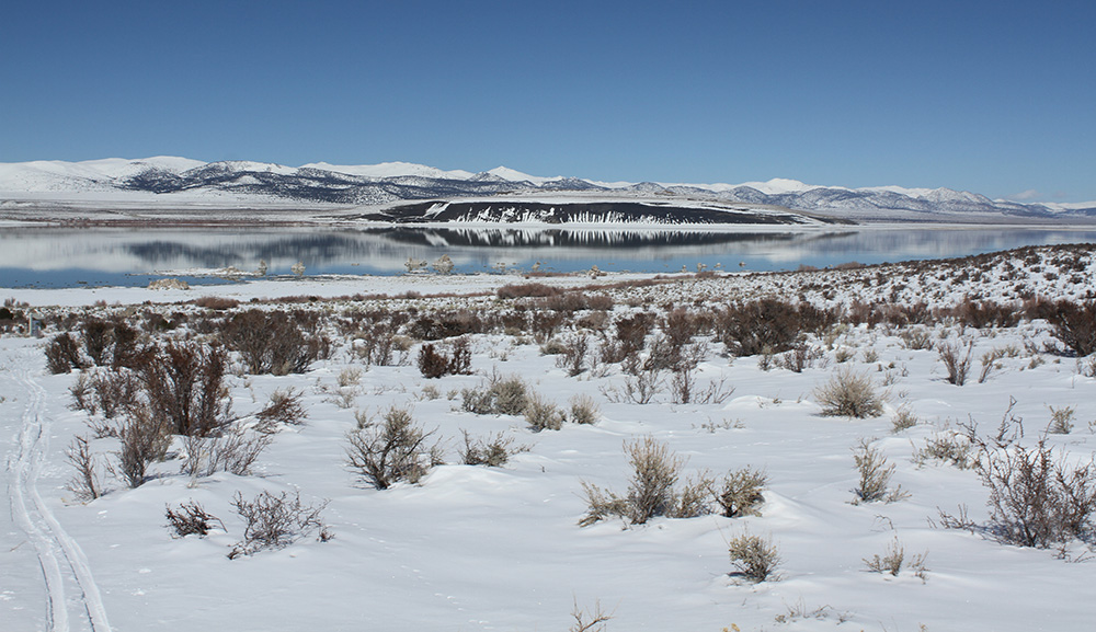
A calm lake surface in not only incredibly scenic but ideal for lake level readings. With the onslaught of storms we’ve experienced this winter, a glassy lake has been a rare sight. Photo by Robbie Di Paolo.
The Mono Lake Committee monitors Mono Lake’s level throughout the year, at least once a month and usually more frequently. You can find monthly lake levels going back to 1971 here. The most important lake level reading of the year happens on April 1st, which is the official start of the runoff year (April 1–March 31). The Committee jointly reads the lake level gauge near Old Marina with the Los Angeles Department of Water & Power and this elevation determines how much water can be diverted from the Mono Basin in the coming year.
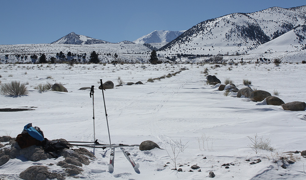
In the winter it’s not so easy as driving down to the gauge for a ten-minute reading. The dirt roads out of Old Marina aren’t plowed so our three February and March readings have required a cross-country ski from Lee Vining. The round trip starting near the Mono Basin Scenic Area Visitor Center is just over two miles and gives gorgeous views towards the snow-ringed lake. To time our trips we watch the weather forecast, hoping to snatch a day of calm water between storms. In the end, however, it’s best to just keep cross-country ski gear ready in the car and jump on the days when we notice the lake looks particularly reflective on the commute to work!
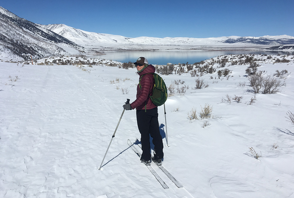
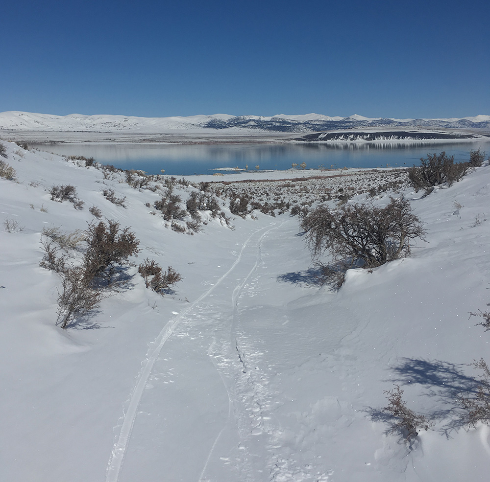
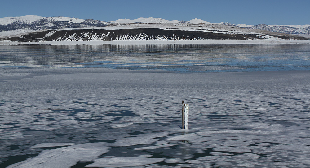
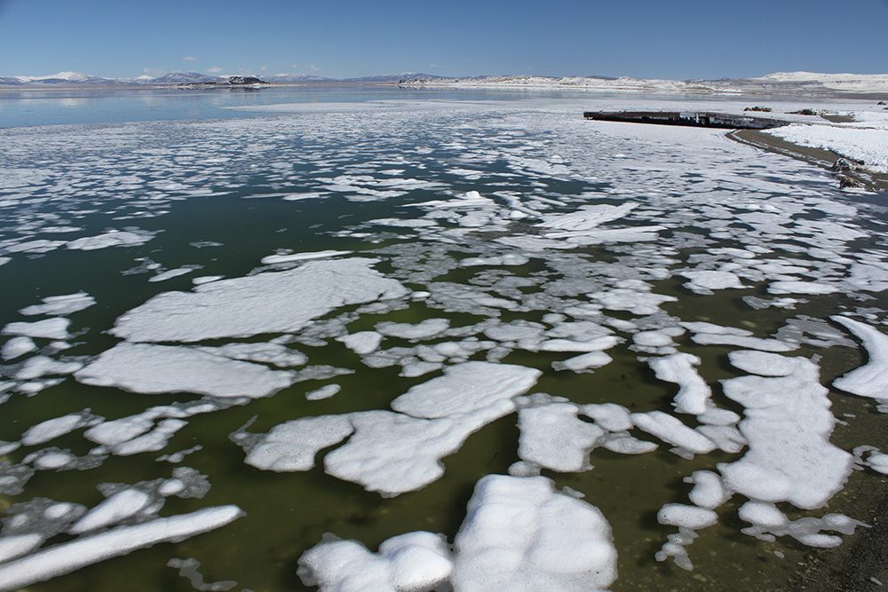
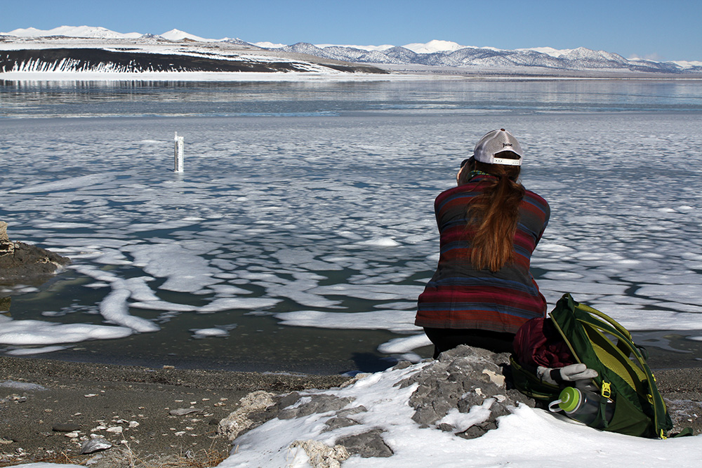
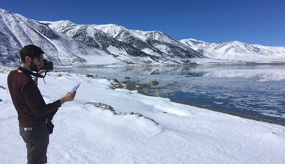
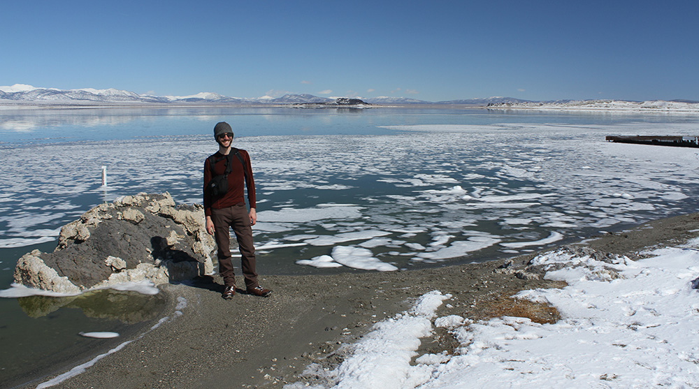
Me heading out from the north end of Lee Vining. Unlike most of the gear-intensive monitoring the Committee performs, the only equipment necessary for reading the lake level are a pair of binoculars, sun protection, and skis. Photo by Robbie Di Paolo.A sufficiently deep snowpack down to the lake allows a shortcut through the sagebrush. Photo by Robbie Di Paolo.Frozen foam on the surface of the lake is an uncommon phenomenon, whipped up by wind and then frozen by cold temperatures. The foam was obscuring our measurements, prompting us to toss rocks in the water to clear it away from the gauge. Photo by Robbie Di Paolo.More frozen foam. Photo by Robbie Di Paolo.Me reading the lake level gauge. The March 4th lake level elevation was 6381.90 feet above sea level. Photo by Robbie Di Paolo.Robbie re-photographs a scene captured in February 2018, documenting the stark contrast in snow coverage between years. Check out the Benchmarks section of the 2019 Winter & Spring Mono Lake Newsletter, available later this month, to see the comparison. Photo by Maureen McGlinchy.Persistent snow along the lakeshore is rare. Lee Vining Creek is in the middle-ground, with Williams Butte and snowy Mount Wood in the distance. Photo by Robbie Di Paolo.Robbie may give the impression that it’s balmy out there, but the air temperature topped out in the high-20s this day. Photo by Maureen McGlinchy.
We use cookies to make this website user friendly, but we need your consent. Learn how we use cookies on our Privacy and Cookies Policy page.I ACCEPTNO THANKSSEE POLICY