
This post was written by Kevin Brown, 2019 Information Center & Bookstore Assistant.
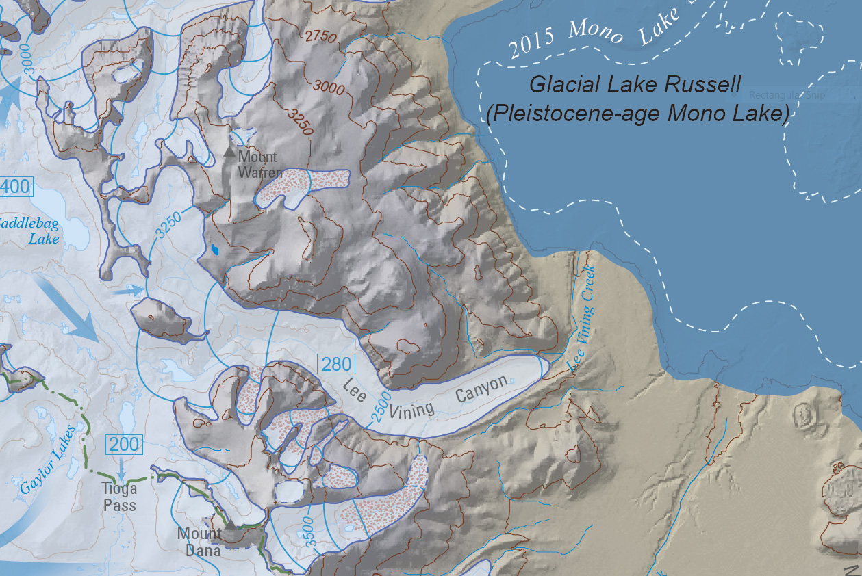
Twenty thousand years ago, a glacier churned down Lee Vining Canyon. Hundreds of feet thick at the top of the canyon, the glacier reached its maximum extent at the site of what is now the US Forest Service ranger station, just west of Lee Vining.
It is now easier to picture this arm of what scientists call the Tioga glaciation thanks to a new US Geological Survey map showing its extent throughout the Yosemite region. Greg Stock, geologist for Yosemite National Park and one of the map’s authors, spoke at the Mono Lake Committee last month. To a packed room, he described the jumble of moraines, boulders, and rock striations that he and his colleagues deciphered to build the map.
But this latest map is based on more than work by Stock and his colleagues. It also draws on the efforts of an earlier generation of scientists. In other words, just as the Tioga glaciation isn’t the only glacial period in the Sierra Nevada’s past, the 2019 map is not the first map of the Tioga glaciation in the park.
Stock explained during his lecture that in 1987 the USGS produced a preliminary map of the Tioga glaciation around Yosemite to be released alongside N. King Huber’s classic book, The Geologic Story of Yosemite National Park. The 1987 map represented a culmination of decades of research by its authors, including a pioneering USGS geomorphologist named Clyde Wahrhaftig, who began exploring the glacial history of the Sierra Nevada in the 1950s.
Wahrhaftig knew the 1987 map would not be the final word on the Tioga glaciation. While the oblique view map (shown below) was incredible for its hand-drawn cartography, it lacked the detail of a plan view map. Furthermore, after publication Wahrhaftig realized it also contained some errors and that further research would be necessary to capture the direction glaciers flowed near the crest of the Sierra at Tioga Pass.
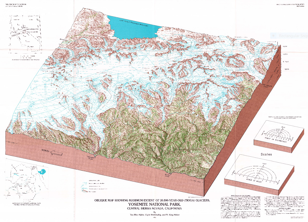
Clyde Wahrhaftig died in 1994, without having a chance to revise the map. The work was so important to him, however, that he left money in his will to help a future researcher pick up where he left off. When Greg Stock became Yosemite’s first park geologist in 2006, Clyde’s family approached him to see if he would be interested. Stock jumped at the chance.
After thirteen years, the map is complete, drawing on new field and lab work, inferences, and digital map-making techniques unavailable in previous decades, as well as Wahrhaftig’s field notes and records. To honor his contributions, Clyde Wahrhaftig is listed as the first author. All future references to the map will be written as “Wahrhaftig et al., 2019.”
Despite all this work, Stock and his colleagues know that they too will not have the last say on the Tioga glaciation in the Yosemite region. In the documentation accompanying the map, they wrote:
“We share [Clyde’s] feeling that more work is needed (and also his reluctance to conclude such a joyful project), but we also recognize that an effort of this magnitude will never be perfect. It is time to share this work and let future researchers improve upon it.”
Here’s to the next map of the Tioga glaciation.