
Last year we were drought weary and went into winter with low expectations. Those expectations were proven wrong—very wrong. 2017 became the winter of storm after storm after storm that led to a spring and summer of genuine awe at the depth of the snowpack and magnitude of the runoff.
It is hard to fathom the scale of what happened. In three weeks in January, scientists note, more than the equivalent of the entire average annual flow of the Colorado River fell as snow onto the Sierra Nevada. And it didn’t stop there. By April the Mono Basin watershed had seen snowfall equivalent to four drought winters—2012, 2013, 2014, and 2015—all stacked on top of each other.
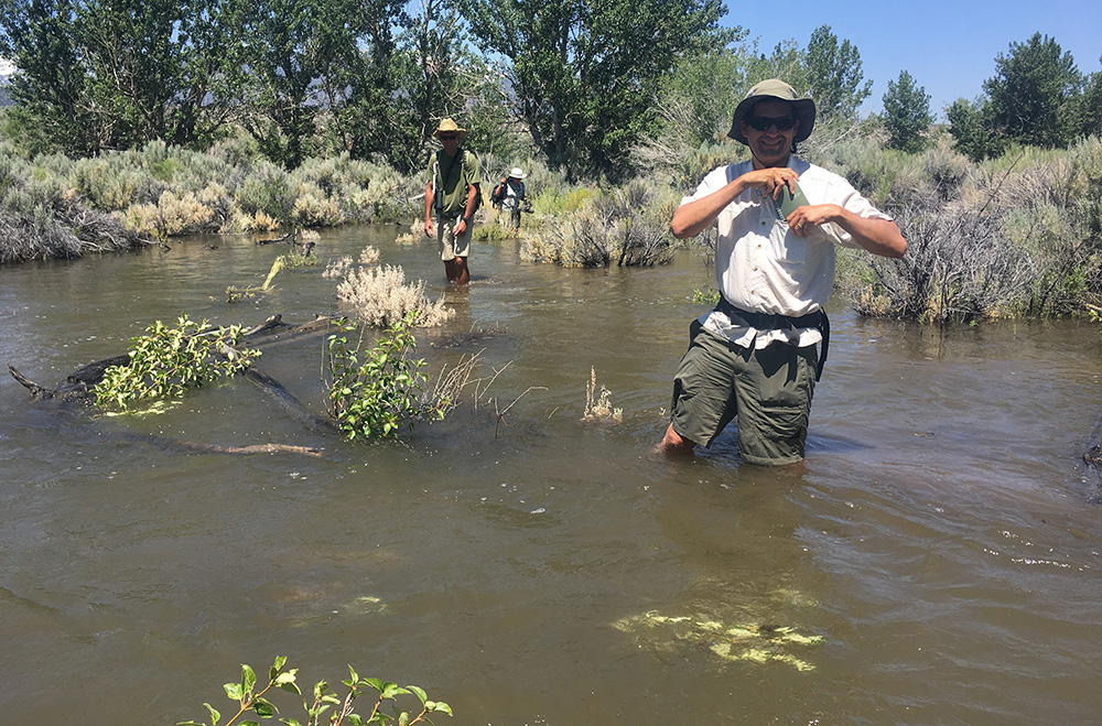
When longer days and warmer temperatures arrived, the snow began to melt and a remarkable runoff season began. The Mono Basin runoff forecast exceeded 200% of average, and it was no surprise that Mono’s tributaries ran high as they filled with immense volumes of melting snow. And then, the high flows lasted week after week—a truly impressive duration. Dynamic pool scouring and channel shaping processes created habitat for fish and wildlife, while overbank flooding, groundwater recharge, and seed dispersal benefited the recovery of the streamside forests. In Lee Vining people remarked on the persistent knocking sound of the stream tumbling boulders below town, while on lower Rush Creek multiple stream channels overflowed, creating a single flowing sheet of water.
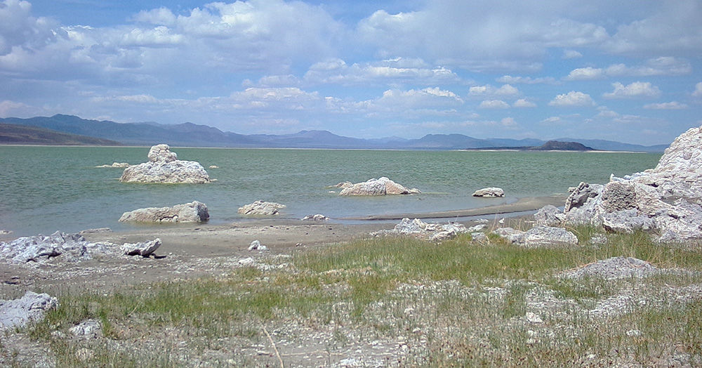
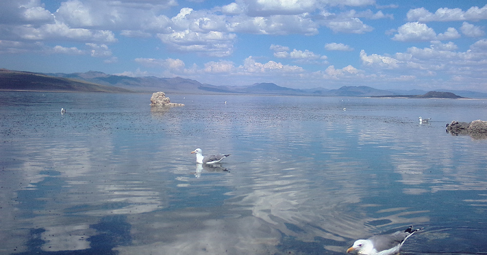
Mono Lake rose rapidly in response to the large streamflows. By July there were times when the lake was rising almost an inch a day—an impressive amount for a lake nearly twice the size of San Francisco. June set a new record for single-month lake rise and July was also impressive. As the lake rose it hid the white alkali shoreline that typified the drought and pushed up into salt grass and shrubs, giving the shoreline a new “rising lake” look. At Old Marina the water flowed back in among the tufa boulders, rejuvenating habitat and almost making the prominent outcrop there an island once again. Out on the flat landbridge the lake’s edge moved daily, eating up shoreline and widening the watery buffer to the nesting islands. Although the lake rose too late to protect the nesting California Gulls this year, the overall rise will be beneficial for the next nesting season.
Overall Mono Lake has risen an impressive four and a half feet since the drought-induced low point in December 2016. It’s a tremendous bounce back from five years of drought and the second-largest rise in lake level since diversions began. Still, the drought caused Mono Lake to fall seven feet, meaning that drought impacts linger at Mono Lake as they do across California.
As the aspens turn golden yellow and orange, last winter’s snow still lingers in select locations high in the Sierra. Summer wildflowers still bloom, sneaking a few more days into a season shortened by late melting snows. Streamflows have fallen back to modest levels—though still high for autumn.
Talk is in the air of what this coming winter may bring us. Perhaps another wet winter—there is some support in the records for wet-year duos. Or maybe a disappointing return to dry conditions?
Here at the Mono Lake Committee we try to hold off on making guesses about the winter until some snow has fallen, but we do look at the range of what’s possible for the lake. A dry winter, if it happens, would lead to a lake level drop of a foot or two. An average winter would add up to a foot. And another extremely wet winter? That could add another four to six feet, and push Mono Lake to its highest level since the State Water Board decision in 1994.
Lack of Grant Outlet still a limitation
For all of the positive things that happened for stream restoration in 2017, here at the Committee we can’t help being a bit wistful. If the new Grant Lake Reservoir Outlet had been in place, as set forth in the 2013 Stream Restoration Agreement between the Los Angeles Department of Water & Power (DWP) and the Committee, this record-breaking year would have done even more to boost the health of Rush Creek. The new outlet in Grant Dam will eventually allow controlled release of high flows to the creek, fixing a serious limitation of the 1930s-era structure that was built to achieve total diversion of the stream. Implementation of the Stream Restoration Agreement is ongoing and the Committee’s continuing vigilance is critical to ensuring that outlet construction gets underway quickly.
Rush Creek’s streamflows were impressively high this year but they never rose to the minimum amounts specified under the Agreement’s new Stream Ecosystem Flow (SEF) requirements that are tailored for fisheries and stream restoration. Given the large volumes of water flowing downstream, it was reasonable to assume that these minimums would be significantly exceeded. The Committee estimated that unimpaired Rush Creek flows (if no aqueduct or upstream reservoirs existed) would have likely peaked almost 50% higher than the peak actually experienced by the creek, demonstrating how old infrastructure holds back wildlife and habitat recovery on the creek.
In fact, several doses of good luck were required to even get close to the SEF requirements. First, the “Extreme-Wet” year type is defined as having runoff of 160% or more of average—2017 exceeded 200% of average, meaning Rush Creek was awash with water in spring. In addition, upstream hydropower reservoirs held back far less water than usual, passing higher flows downstream and causing Grant Lake Reservoir to fill and, thus, spill more quickly. As a result, Rush Creek flows arrived in about the best pattern possible without an outlet—but there’s no reason to expect similar results in a future year, especially one closer to the 160% of average mark.
What 2017 has reinforced for us, through documenting on-the-ground results, is this: The principles that guide stream restoration at Mono Lake work. Mimicking the natural pattern of Sierra snowmelt runoff, as required by the State Water Board, is the ticket to restoring stream and fishery health.
The corollary is clear: The Committee must remain persistent and vigilant to ensure full implementation of the 2013 Stream Restoration Agreement. If DWP prepares the necessary documents on schedule, the process of license amendment through the State Water Board will be complete in the coming months. And that will initiate construction of the new Grant Outlet, make the SEFs mandatory, and ensure that when the next big winter rolls around Rush Creek will see the most restorative streamflows possible.
________________________________________________
Decades’ worth of restoration progress
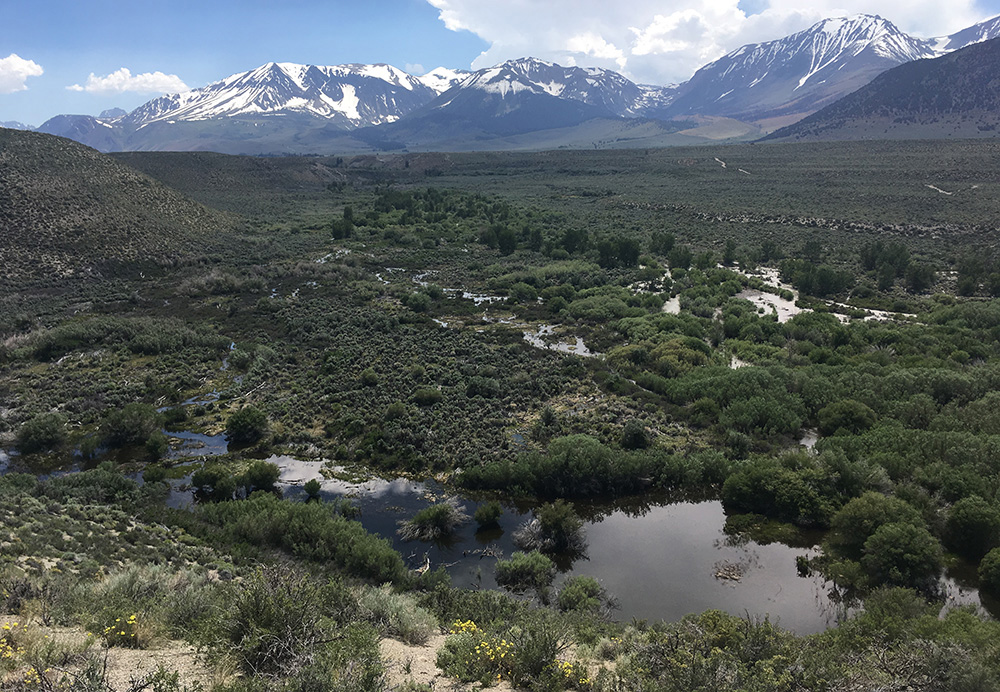
During the week of the summer solstice, when snowmelt runoff peaked, each day that passed was equivalent to an entire year of changes for Rush and Lee Vining creeks. This tremendous geomorphic work continued beyond that week, adding up to decades’ worth of restoration in only a month.
Trees that the Committee planted in 1996 along a recently reopened Rush Creek side channel toppled into the water, providing complex large woody debris habitat to the channel as intended. New channels formed and existing channels shifted daily. Floodplains that hadn’t been flooded in decades were awash in deep fast-moving water, accumulating fresh sediment. After a summer of dramatic restoration progress, it is exciting to see where the low-flow channels are ending up as the flows decline. —Greg Reis
________________________________________________
SCE moves extra water for safety
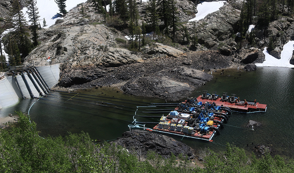
To manage extraordinarily high runoff in the Rush Creek drainage over the summer, Southern California Edison (SCE) took unprecedented action to bypass flows at its hydroelectric facilities. Water normally flows through a series of high-elevation reservoirs (Waugh, Gem, and Agnew), generating hydropower at the Rush Creek power plant. When the capacity of the system is exceeded, water spills over the dam spillways. But as a result of seismic concerns, SCE was ordered to keep all three reservoirs at 50% capacity for public safety reasons since communities in the June Lake SCE moves extra water for safety area lie directly downstream. In spring, SCE engineered pipe modifications and a pump system to carry 500 cubic feet per second (approximately five times the power plant capacity) over the Agnew Lake Reservoir dam. All season, helicopters could be seen flying materials and personnel into the Agnew area, and then out again, after the flows subsided. It is not clear whether or not this will be a permanent operational strategy—it will likely depend on future snow amounts and if the seismic concerns can be addressed with infrastructure improvements. —Lisa Cutting
This post was also published as an article in the Fall 2017 Mono Lake Newsletter (pages 3, 4, and 17).