
Now available on the Mono Basin Clearinghouse are documents pertaining to the construction of the Mono Basin extension of the Los Angeles Aqueduct:
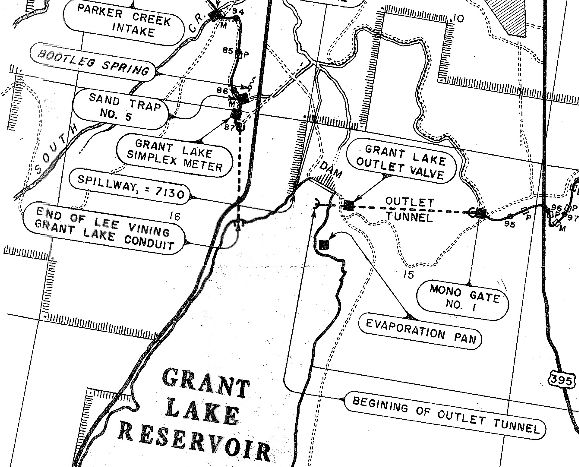
Map of the LA Aqueduct facilities from Lee Vining Intake to West Portal
A 4.3 megabyte download, this high-resolution JPG file shows the control stationing and original names of most of the features of the Mono Basin portion of the LA Aqueduct. Click on the image at right to enlarge, or click on the link above to download the full map.
1933 Map of Mono Basin property ownership, hydrographic stations, wells, test holes, gages, and streams
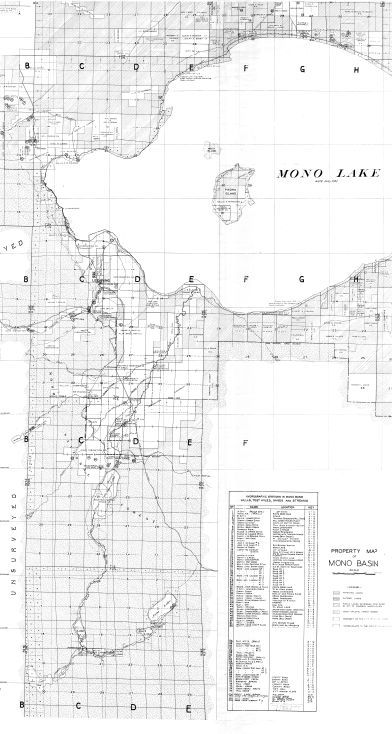 A 2.4 megabyte download, this high-resolution PDF file shows the Mono Basin as of 1933. Included on the map are property ownership and water-related infrastructure. It also shows the (at that time) proposed aqueduct route, including the never-constructed Mill Creek extension. The outline of today’s Grant Lake Reservoir is also shown–larger than the 1933 irrigation reservoir. Click on the image at right to enlarge, or click on the link above to download the full map.
1935-1941 annual reports of the Board of Water and Power Commissioners of the City of Los Angeles
We’ve posted portions of seven annual reports spanning the construction years of the Mono Basin extension of the LA Aqueduct. Each report has information about that year’s construction activities, and in some cases photos and details of the construction effort. Click on the link at the top to download these.
On Saturday July 31st, the Mono Basin Historical Society will be conducting a tour of Grant Lake Dam and West Portal, and the theme will be “1940 in the Mono Basin,” the year that the aqueduct was completed. Click here for more information.