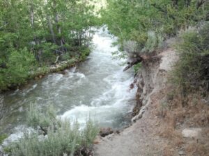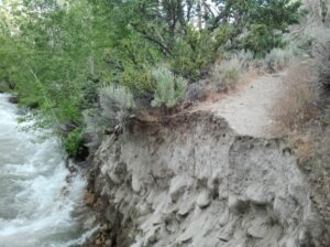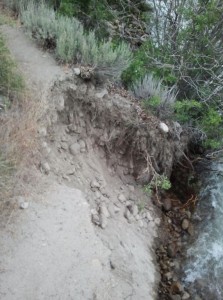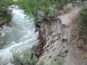
Lee Vining Creek continued to flow Thursday at exceptional levels following a July 5th peak at 535 cubic feet per second (cfs), resulting in a ten-foot section of the Lee Vining Creek Trail being washed out. It is on a steep hillside with a big drop from the trail to the creek. There is a short but steep detour above the washed out section.
Elsewhere along the creek, channels were deeply scoured and some were abandoned, floodplains were flooded, and large woody debris was moved. This flood has had the greatest effect on the creek since the January 1997 rain-on-snow flood last “reset” the floodplain. With two peaks over 530 cfs during the last two weeks, a lot of “work” was being done as the flow shifted between channels.
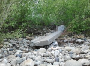
The A-4 Channel runs along the hillside below the Scenic Area Visitor Center, and was rewatered in 1994 as part of the stream restoration efforts. The first peak on June 24th put a tremendous amount of water down this channel, knocking over a concrete wall that used to be part of the headgate for a historic irrigation ditch.
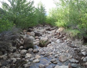
Then the entrance was plugged with cobbles and the main channel downcut and moved away from this channel’s entrance, leaving it high and dry. Look at the size of these boulders that were rolling down the channel when it dried up—each of these large boulders is at least three feet in diameter!
Even at Thursday afternoon’s flow of about 100 cfs lower than the peak, the clunking of cobbles rolling down the main channel was often audible over the roar of racing whitewater. The main channel is now taking a higher flow than at any time since 1997, due to the entire flow of the A-4 Channel now being added to it.
We are very much in the middle of the peak flow period, and into the weekend the flows in the Mono Basin streams will remain very close to their highest levels. Cooler weather will limit snowmelt, and flows will begin to decline by early next week. The exception is Rush Creek—as Gem Lake Reservoir starts spilling, flows downstream will increase dramatically.

