In September, the Great Basin Unified Air Pollution Control District released its Reasonable Further Progress Report for the Mono Basin PM-10 State Implementation Plan. You can download the 17-page PDF file from the Mono Basin Clearinghouse Website. The report summarizes progress since the last update in 2007 (the previous reports can be downloaded as well).
During the first six months of 2010, dust storms emanating from the exposed lakebed of Mono Lake exceeded federal air quality standards sixteen times (17 in one year would be a new record). The highest concentrations of PM-10 dust were measured in 2009, at almost 100 times the federal standard the highest concentration ever measured.

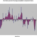
The dust problem is severe. Because Mono Lake has been rising slowly–it has fluctuated around 6383 feet during the past 14 years of average runoff. In response to the concern that the lake had stabilized–contrary to all previous modeling results–the Committee ran a preliminary analysis that showed such a conclusion to be premature. We adjusted the Los Angeles Department of Water and Power’s annual lake level forecasts for actual runoff and precipitation. This resulted in a predicted lake level very close to what actually has occurred. The reason the lake has not risen faster appears to be lower-than-average precipitation over the lake (75%), compared to the average precipitation and runoff in the Sierra. This condition appears to be cyclical, and not necessarily a new shift in climate–therefore it is not necessarily outside the range of the current model projections. The models projected the lake would rise from 6375 feet to its future stabilization level of 6392 feet in 9-38 years. It is now 16 years since those projections were made.
While it is still early in the range of time projected for Mono Lake to reach its stabilization level, the concerns raised in the SIP update are real, and additional analyses need to be done. The lake level models haven’t been updated since the early 1990s. The Committee is in the process of updating Peter Vorster’s model–the most detailed–and we are looking forward to engaging in a cooperative process to update the Water Board’s model (upon which its Decision 1631 was based). LADWP has developed a new model based on its early-1990s model, which may be a useful tool in the cooperative effort. See the Fall 2010 Mono Lake Newsletter for more details.
