
This post was written by Julia Runcie, 2011 Project Specialist.
As a Mono Lake Committee Project Specialist, my duties are many and varied. From working in the Information Center & Bookstore to drafting grant proposals to pulling invasive weeds, I never seem to be doing the same thing for more than a few hours at a time, and each new project is an exciting surprise.
Last week our communications team gave me an interesting assignment. Every issue of the Mono Lake Newsletter features a “benchmark”—a pair of photos, one old, one current, showing a before-and-after snapshot of a particular site in the Mono Basin. This time we had the “before” photo, a shot taken by Burton Frasher in 1938. But the “after” photo would require a bit of exploring. It was necessary to determine the exact location from which the photo had been taken, tramp out through two feet of fresh snow to find that spot, and recreate the same scene in the present day. Needless to say, I was thrilled.
After lunch I drove three miles north of Lee Vining to the spot where Highway 395 curves around the Tioga Lodge in a distinctive arc. Both the curve and the Lodge itself were visible in the 1938 photo. I parked well beyond this point so that my truck wouldn’t mar the photograph, then backtracked along the shoulder of the highway. My next landmark was a small grove of poplars on the hillside above the road. I found the trees easily enough, but I realized that if I hiked straight toward them my snowshoes would leave an unsightly track right through the middle of the shot. So I plowed my way up a gully to the south of the poplars, then traversed the hillside until I thought I could safely drop down to the correct location.
I had two further guides: a telephone pole, replaced at some point over the past 73 years but still in roughly the same spot, and a large block of ice age tufa, now mostly buried in snow. Both were right where I’d hoped to find them. Now the task was to frame a shot as nearly identical as possible to the 1938 photo. I studied the original in its waterproof sheath, holding it against the view, trying to discover the angle from which Frasher had taken aim. Something just wasn’t quite right, and for almost two hours I trudged up and down the hillside, sometimes crouching, sometimes holding the camera above my head, and once even doing my best to climb an uncooperative pinyon pine. My landmarks simply refused to stay aligned: either the far hills snuck out of the top left corner of the frame or the tufa block crept too far toward the center. Several times my perfect photo was ruined when cars driving by below made an unsightly parade of headlights along the bottom of the shot.
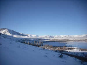
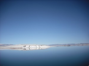
Finally, as the sun dropped behind the hills and I began to feel the chill, I decided I had taken enough pictures. One of them, surely, would be adequate. Regardless of the exact angle and framing of the shot, the change in the lakeshore between the “before” and “after” photos is manifest: yards and yards of exposed land and vegetation extending out below me where in the 1938 picture there had been only water. You’ll be able to see this remarkable contrast for yourself in our Winter-Spring 2011 Newsletter, which will be available for members on the website by March 15 and in your mailbox by April 1.
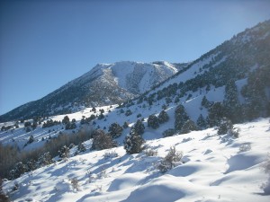
One of the most rewarding aspects of spending a year in the Mono Basin has been the opportunity to observe the slight changes that mark the passage of time. I’ve enjoyed seeing the birds and wildflowers that come and go, the streaky clouds that heralded the end of summer, and the first skims of surface ice on the lake’s north shore. My adventure in the hills above town taught me to appreciate a more dramatic transformation, and to reflect on the further differences I may witness if I stay to watch Mono Lake’s waters rise.
The photo from 1938 showing the lake almost up to the road brought back great memories of when my family used to drive by on our way to Lundy for the summer. Mono Lake always seemed to me, as a kid, to be everlasting and indestructable. Then after college and 25 years in the Army I returned to find the lake deminished and hurting from lack of water. Thank God for the hard work of the Mono Committee and all those involved in restoring the Lake to its present level.