
Most days in the Mono Basin provide clear air and stunning scenery, but because the Los Angeles Department of Water & Power has diverted water from Mono Lake’s tributary streams for 85 years, the exposed lakebed can emit toxic dust when the wind blows. Sunday, May 17, 2026 was one of those days and the timelapse video is remarkable.
Particulate matter air pollution at Mono Lake reached an extreme level of exceedance at the Mono Shore station, northeast of Mono Lake, with one-hour PM-10 concentrations reaching 10,234 micrograms per cubic meter (μg/m3). For comparison, good PM-10 air quality ranges in hourly concentrations of 0–171 μg/m3, with hazardous concentrations above 892 μg/m3.
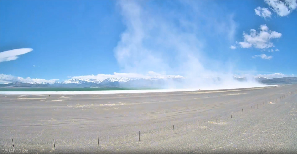
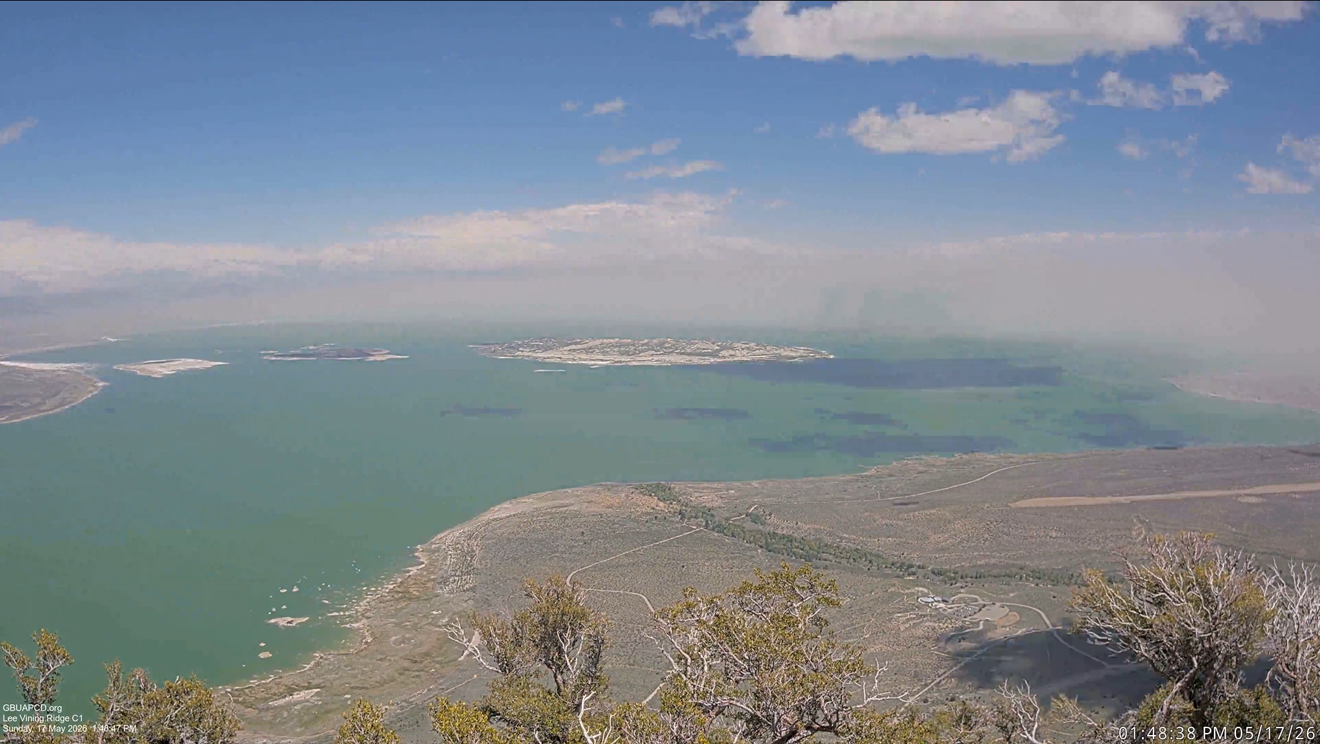
While the greatest concentrations were likely to be closer to the north and northeast shore, alkali-laden mineral dust blowing off the exposed lakebed traveled across the lake, reached the south shore, and shrouded the eastern horizon and Mono Craters. Motorists on Highway 120 East and visitors to South Tufa encountered unhealthy air. The PM-10 air pollution eventually wrapped around from the south and entered the towns of June Lake and Lee Vining.
Timelapse videos from May 17
Mono West air quality monitoring camera (located on Mono’s northeast shore)
Lee Vining Ridge air quality monitoring camera (located on the Warren Bench west of Mono Lake)
Cameras operated by the Great Basin Unified Air Pollution Control District
The solution to this recurring problem was mandated 32 years ago, but it has yet to be realized on the ground—put more water in Mono Lake and raise it to 6,392 feet. The California State Water Resources Control Board mandated a lake level nine feet higher than we have today to submerge the dust-emitting playa and protect air quality along with a host of other Public Trust values. “Halfway there” is not good enough—as we saw on May 17.
DWP has maximized diversions each year over the decades since the 1994 decision, and that amount of water, easily replaced by other sources in DWP’s water portfolio, could otherwise flow into Mono Lake and incrementally submerge exposed lakebed and mitigate air quality violations each year.
It has been a generation since the State Water Board mandated a higher lake level, yet the Mono Basin continues to suffer from some of the worst particulate air pollution in the nation, far exceeding federal Clean Air Act standards and California Ambient Air Quality Standards. While DWP has spent over $2.5 billion dollars at Owens Dry Lake to remedy air quality violations caused there, they continue to evade the true cost and problem at Mono Lake.
Top photo courtesy of Nathan Taylor: Midday on May 17, 2026, dust storms were starting east of Mono Lake.