
Snow surveys conducted around every April 1st coincide with the average date of peak snowpack. This year, the surveys were completed at the end of March and revealed a large increase in snowpack over the previous month—from 50% of average to 76% of average!
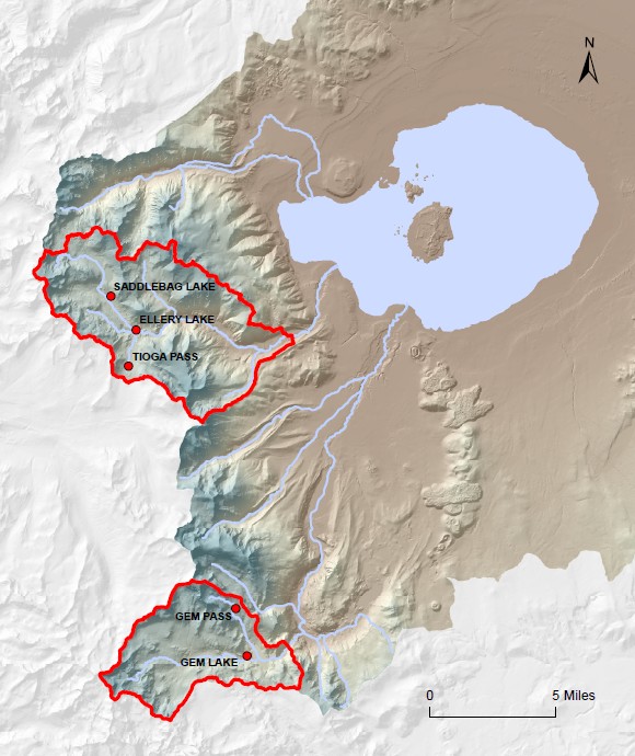
There are six sites where snow is measured in the Mono Basin, as well as at Agnew Pass, which is lumped in with the San Joaquin Basin but usually not used in the Mono Basin average. Gem Pass is at the highest elevation and Gem Lake is at the lowest.
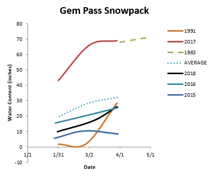
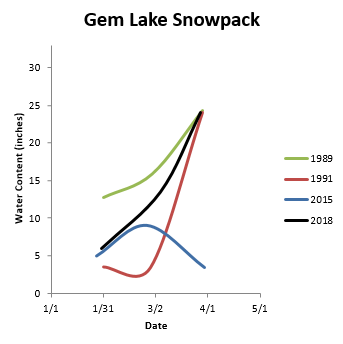
These are just two of the locations where snow is measured, however they each tell a different story. Gem Lake, the lower elevation survey site, was much closer to the 2015 snowpack on February 1, while Gem Pass, the higher elevation survey site, was about halfway between the 2015 and 2016 levels in February, and had a less dramatic rise in March. March 1991 was widely regarded as a “Miracle March” and clearly had a much greater increase in snowpack than either location has seen this year. However, Gem Lake snowpack in 2018 could be regarded as a minor miracle.
And with a very wet atmospheric river storm expected this weekend, water conditions in April will only continue to improve.
[…] View Original Article […]