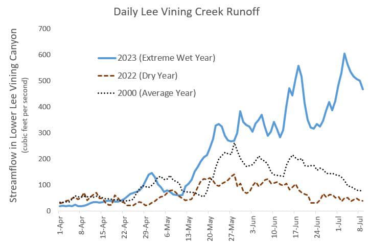
High-elevation snow is melting in the Mono Basin and we are enjoying quite a show of runoff. The winter of 2022–2023 broke records for snowpack and we’ve been watching that snow gush down Mono Basin creeks. Cool spring and early summer temperatures meant a slow start to the runoff season. Now this week’s heat wave and resultant melt is producing the highest daily flows of the season and likely the biggest peak of the year. Here’s a rundown of the season’s big runoff on Mono Lake’s two largest tributaries.
Rush Creek
On Mono Lake’s largest tributary, flows to the lake have exceeded 800 cubic feet per second (cfs). Think of one cubic foot as a basketball floating by—now imagine 800 basketballs passing you every second!
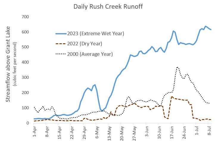
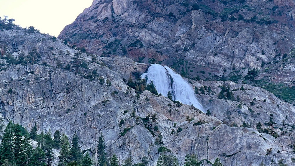
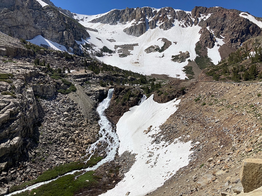
Rush Creek’s natural flow is impaired by several reservoirs and dams, from Waugh Reservoir at an elevation of 9,400 feet to Grant Lake Reservoir, just seven miles above Mono Lake. To experience a truly unimpaired runoff peak, those reservoirs must be full and spilling over their dams. High releases from Gem Lake on Rush Creek has contributed to a spectacular Horsetail Falls this season in June Lake.
Grant Lake Reservoir has been low for several years. This season’s snowmelt has filled the reservoir, which rose over 30 feet and started spilling on June 7th. We expect the reservoir to continue spilling through this month and into August.
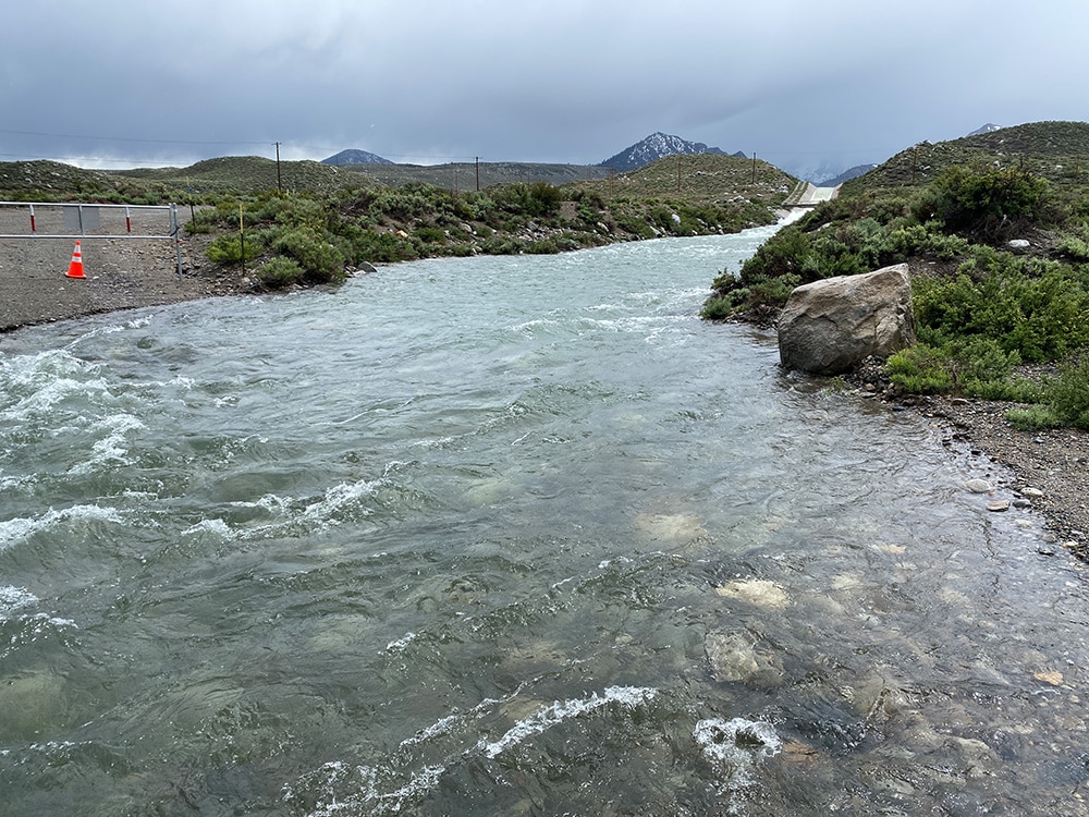
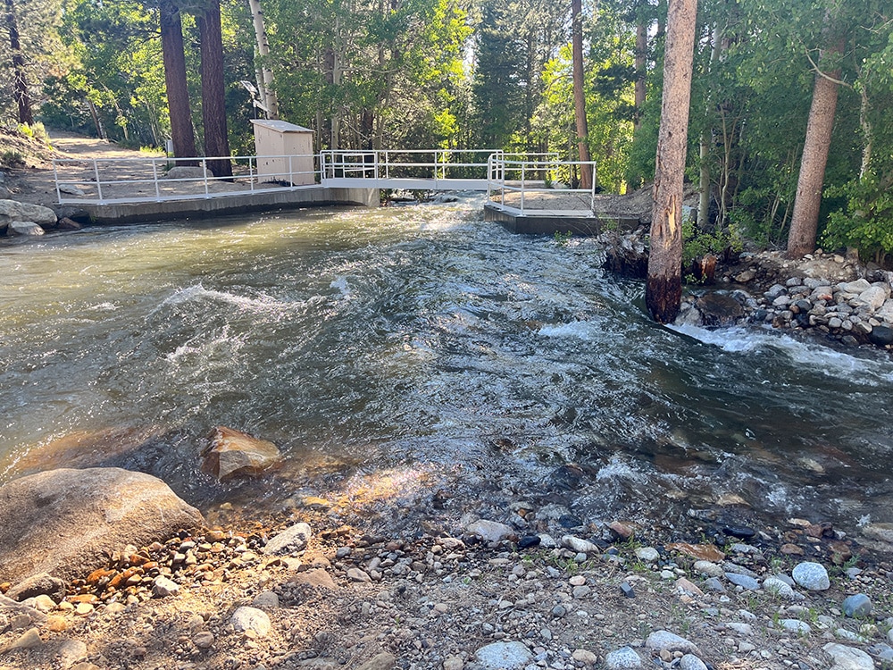
Meanwhile, mandatory flows have been delivered around the Grant Lake dam via a pipe and ditch, maxing out the capacity of that infrastructure at over 380 cfs. This flow meets the spillwater in Rush’s natural channel, about a half-mile below the reservoir.
Parker Creek and Walker Creek join Rush one to two miles below Highway 395, each contributing its own high (though relatively modest) flow. From here, Rush’s rising waters spread into multiple channels in its bottomlands, boosting the creek’s nature-based restoration.
The full flow of Rush comes back together at Test Station Road, all 800 cubic feet per second, then travels the last mile down to Mono Lake.
Lee Vining Creek
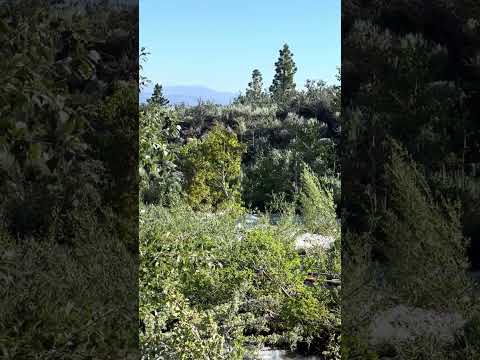
To witness Lee Vining Creek’s high-elevation streamflows this year, you’ll need a pair of walking shoes or a good bike. Highway 120 West remains closed to cars in Lee Vining Canyon but we have reports of Lee Vining Creek overtopping its culvert and flowing over Saddlebag Road at the junction with Hwy 120.

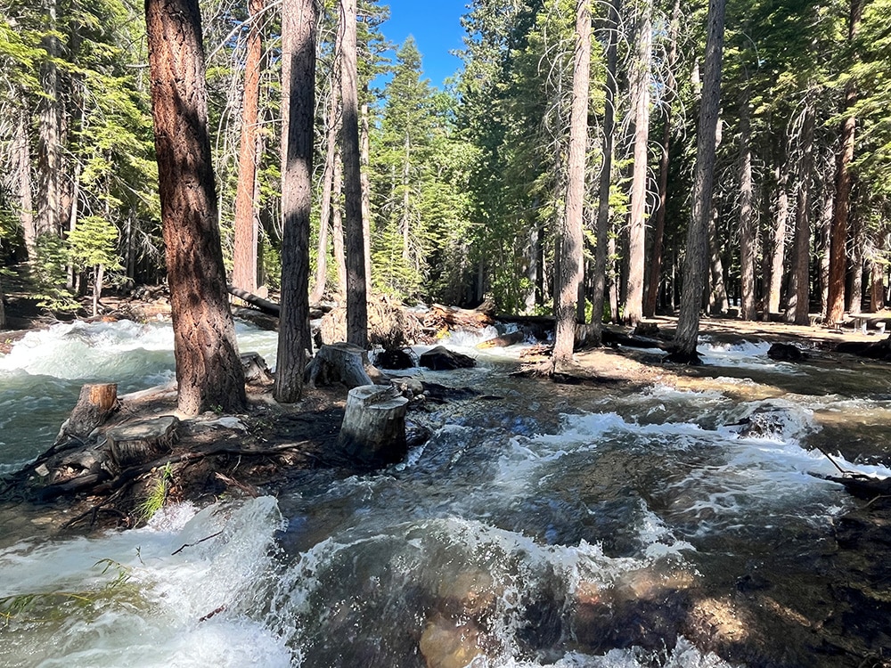
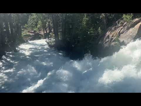
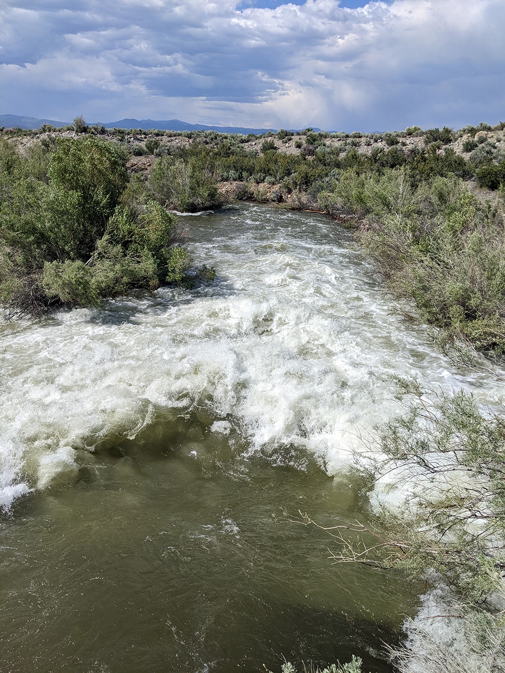
High flows in lower Lee Vining Canyon have caused roaring cascades, closed campgrounds, (above) and complications in streamflow measurements. Lee Vining Creek streamflow is measured just above the diversion pond. The height of the flows has allowed a portion of the creek to bypass the infrastructure of the stream gauge and therefore escape measurement. DWP manages the gauging station and staff are estimating the missed flow.

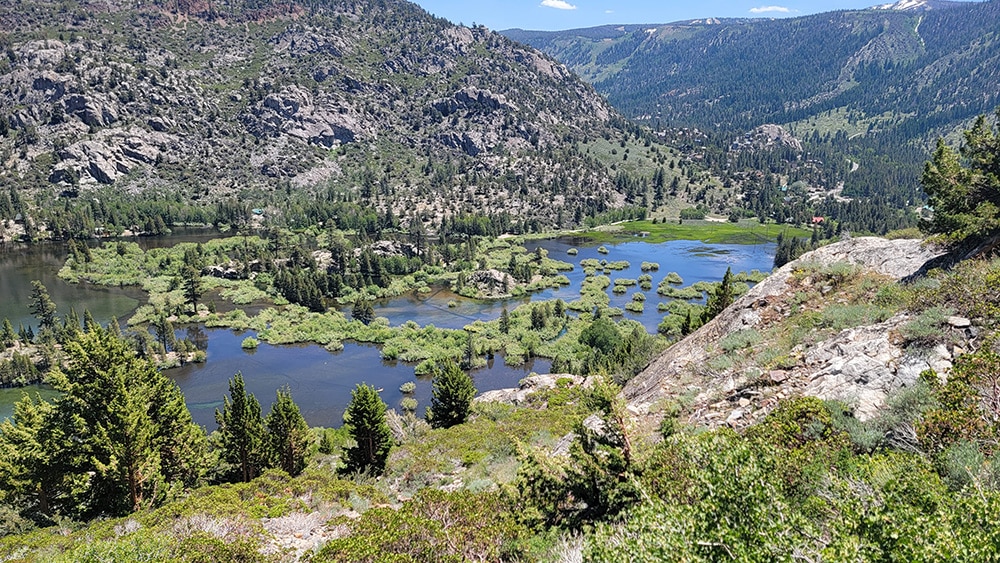
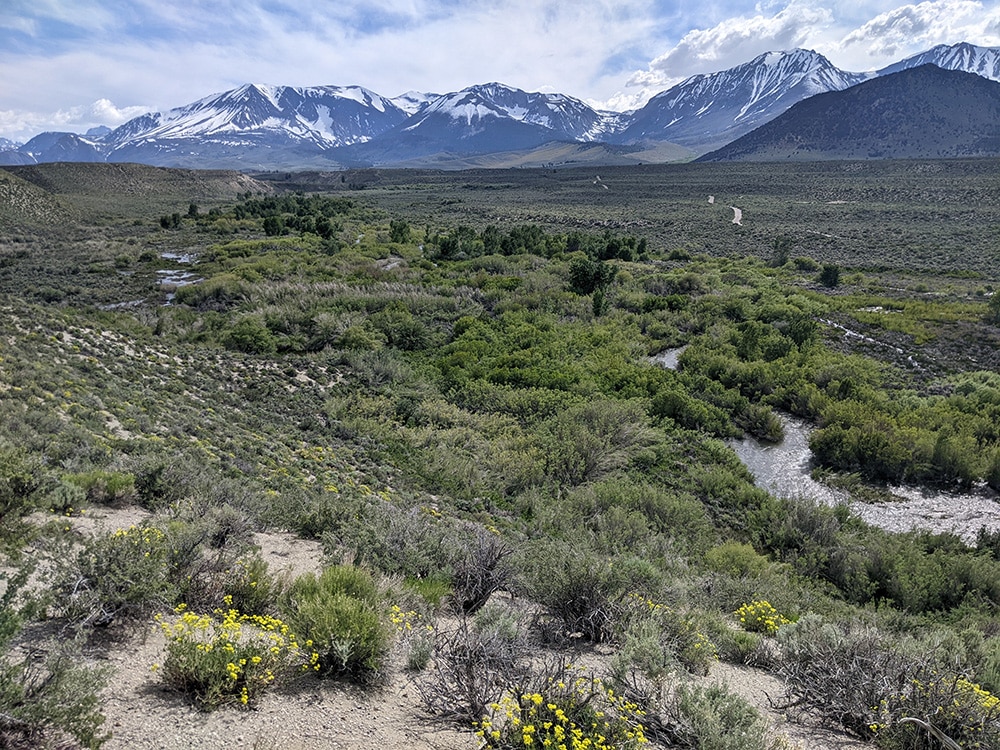
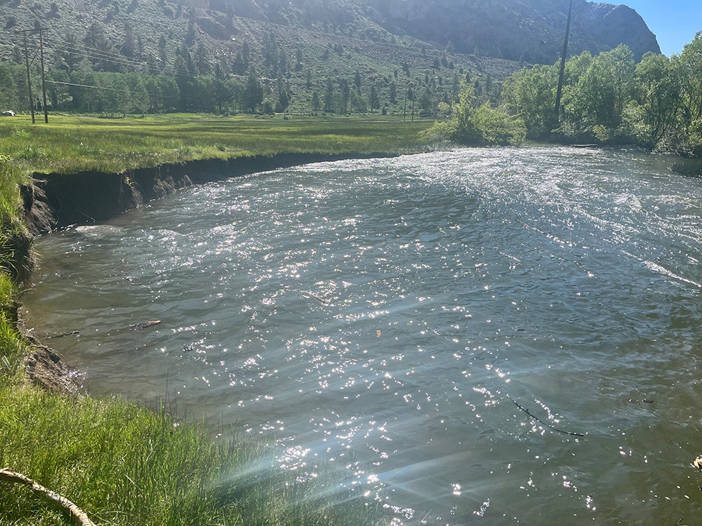
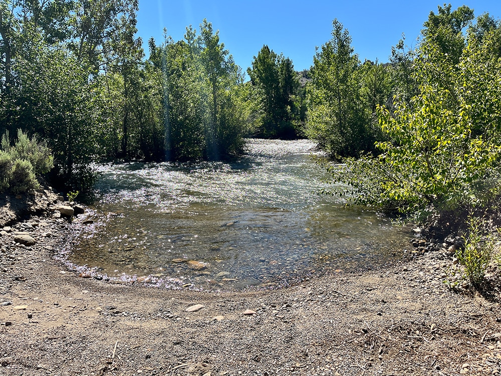
The section of creek below the town of Lee Vining is spreading across channels. The rising groundwater table is the perfect seedbed for riparian vegetation like cottonwood, willow and aspen, furthering the restoration-in-progress.
The Lee Vining Creek “crossing” at Picnic Grounds Road is more uncrossable than ever, as the width of the creek has more than doubled.
Rush Creek and Lee Vining Creek inflow, along with other exceptionally high inflows this season, has raised Mono Lake nearly four feet since December 2022. We look forward to the lake’s continued rise in the coming months as Mono Basin snow continues to melt. But the benefits of a big winter go beyond the much-needed lake rise. Mono Lake’s tributaries, large and small, will use this year’s extraordinary flows to accelerate restoration processes.
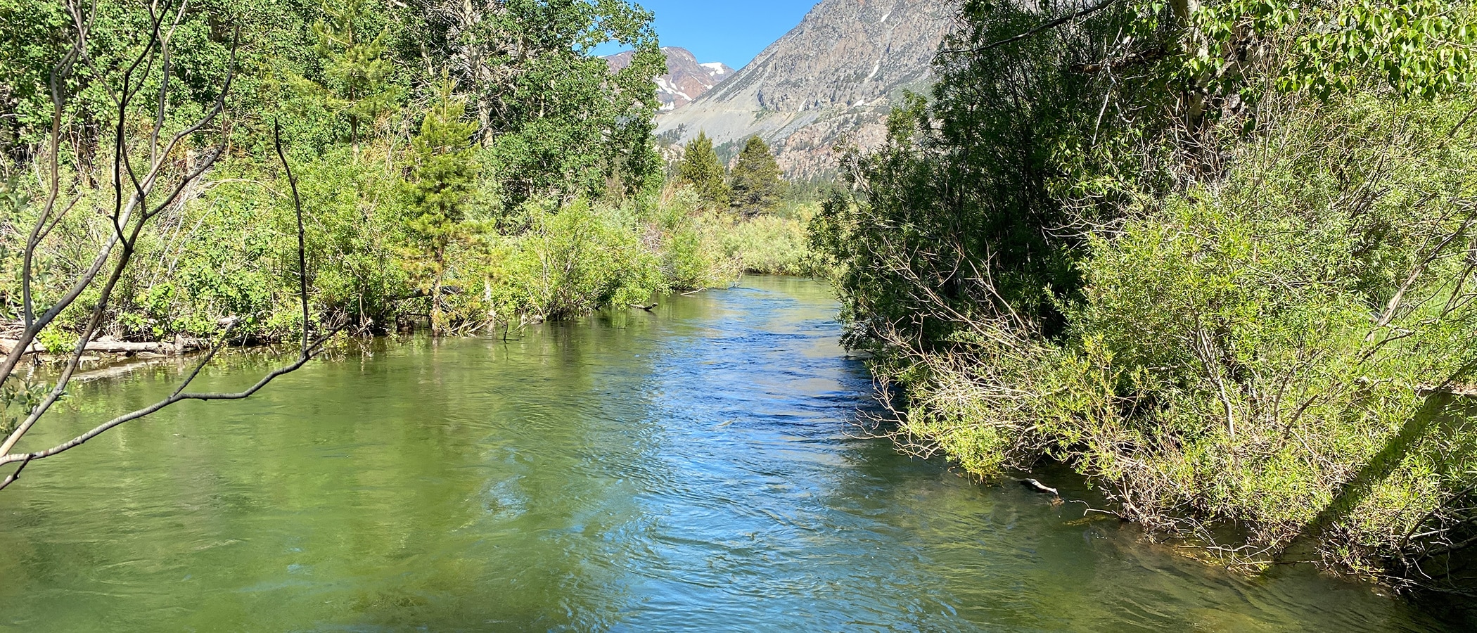
Top photo by Elin Ljung: Lee Vining Creek downstream of Aspen Campground on July 9, 2023.
Thanks for this story with its short video clips. I remember playing in Lee Vining creek at the Aspen Campground with my daughter and her buddy years ago. Also I really appreciate the tour Nora Livingston gave me of the Rush Creek facilities and restoration area last October. Keep on saving Mono Lake!
Kate
The last photo is the big pullout by the rickety old wood bridge? We parked there and went birding beyond the bridge during the Mono Chautauqua – this is amazing and such great news. thanks for all the videos and photos