
The big water question of this year for Mono Lake—I expected—was going to be the same as 2016: Would Los Angeles be halted from exporting water due to Mono Lake’s low level, or would the already-reduced export allotment continue?
The rule is well established: When the lake drops below, or is forecasted to drop below, 6377 feet above sea level, water exports must halt. So our action plan was for detailed lake level forecasting and analysis (last year the lake remained a mere two inches above that critical level) and a fair amount of discussion with the Los Angeles Department of Water & Power (DWP), to be sure any export cutback happened smoothly. In fact, I visited with the head of DWP’s aqueduct system and water operations in December to talk about this very topic.
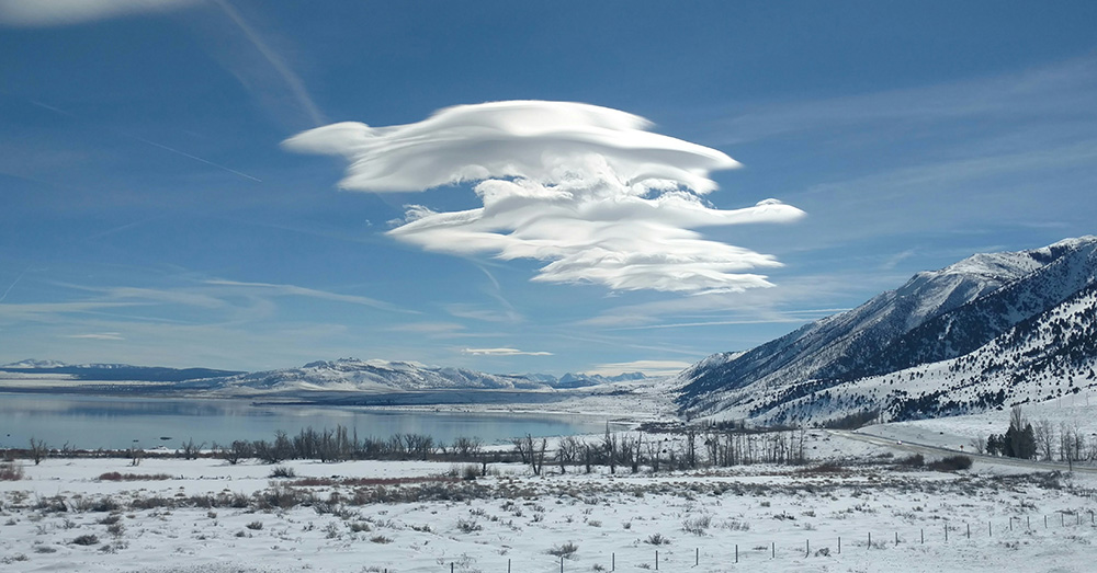
But then came January and February, and the weather patterns of the Pacific gave us a rather wonderfully different reality to work with. One after another, atmospheric rivers brought record snowfall to the Sierra Nevada—including the high-elevation mountainous terrain of the upper Mono Basin watershed. At press time the lake has already risen a foot, and February snow surveys showed the water content of the Mono Basin snowpack at nearly 200% of normal.
As a result, I’m crossing “water export cutback” off the issue list for 2017. Analysis by Mono Lake Committee staff and experts shows there is now essentially no chance that the lake will fall below the key 6377 level this year. That’s good news for the health of Mono Lake, and good news for Los Angeles as well.
So what will happen? DWP will be able to export 4,500 acre-feet of water to Los Angeles, an amount set by the California State Water Resources Control Board in its 1994 Mono Lake decision. The decision also allows for larger exports of up to 16,000 acre-feet if the lake is above 6380 feet on April 1. That was the regular export before the drought, but is an improbable scenario this year.
The year’s export allocation points to a larger truth: this wet weather is a welcome change in hydrologic direction, but recovering from the five-year drought is a tall order. The lake won’t leap back to recover the seven feet lost during the drought years in a single season. And it still has 14 feet to rise to reach the ecologically sound management level of 6392 feet set by the State Water Board.
Evidence of the drought—which included the driest year ever recorded in the Mono Basin—is easily seen in the lake level. The impacts of a low lake are many—ranging from increased salinity impacts on the ecosystem to exposure of the California Gull colony to predators crossing the landbridge.
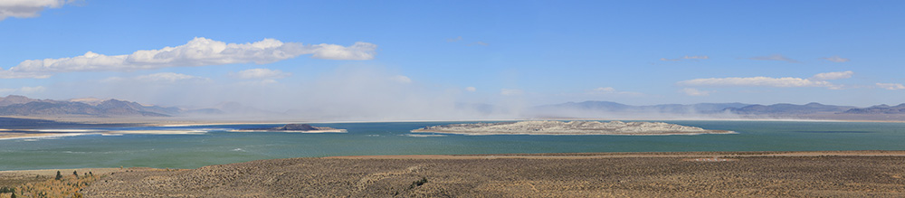
Drought worsened lakebed dust storms
Air quality is another connected, and critical, area of drought impact. As the lake drops, more salty lakebed is exposed to winds that whip up dust storms containing fine particles and toxins that are hazardous to human health. Indeed, the drought exposed an additional six and a half square miles of lakebed by December 2016.
Every year, wet or dry, these dust storms violate Clean Air Act standards—a problem that will be solved when the lake reaches its all-important management level. Recent data shows that these dust storms have become more numerous as a result of the drought.
The Great Basin Unified Air Pollution Control District (Great Basin), the agency in charge of regional air quality enforcement, operates a sophisticated set of monitoring equipment to measure airborne dust from the exposed lakebed. In fact, Owens Lake and Mono Lake produce the largest particulate air pollution events in the nation, and Great Basin has had to develop special instruments and protocols uniquely tailored to these very dense dust storms. We checked in with them recently to learn what effects the drought has had in the Mono Basin.
Did the drought years produce more frequent, or bigger dust storms? Not always. In the first years of the drought, violations numbered ten or more annually, which was fewer than expected. The most likely reason was that weather patterns were not conducive to generating large dust events.
As the drought continued, though, and Mono Lake continued to drop, things got notably worse. The last drought year, 2016 (with the lowest lake level since 1995), set new records. “Exceedances” are days when, over the course of 24 hours, the average particulate count exceeds the federal standard. 2016 produced 33 such days—about 30% more than the previous record number. And it wasn’t just the number of days: 2016 also set a new record for dust storm severity. The maximum recorded particulate density was 6,507 micrograms per cubic meter—25% higher than the previous record and a whopping 43 times the federal health standard.
The fix to this serious problem is straightforward: raise the lake. The State Water Board noted that a key purpose of the 6392-foot management level is to “reduce blowing dust from presently exposed lakebed areas in order to protect health and comply with federal air quality standards.” Answering the question of how long that will take is an active area of analysis and modeling. Wet winters, like the one we are seeing now, will raise the lake, and each bit of progress toward the management level will be a positive step in controlling dust storms and complying with the Clean Air Act.
This post was also published as an article in the Winter & Spring 2017 Mono Lake Newsletter (pages 3 and 4).