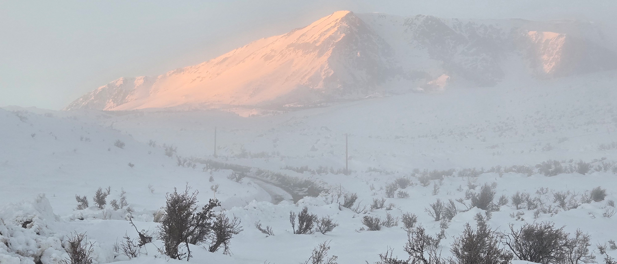
Winter started out wet, but January was dry. In Lee Vining, there were only 3.7 inches of new snow measured in January, and none fell since January 8. The Mono Basin was blanketed with snow and then covered in poconip fog. This insulated the lower elevation snow while warm sunny days melted the higher elevation snow, resulting in an inverse snow line in some places that matches the inversion layer.
This wet-then-shifting-to-dry weather pattern is starting to look like 1997, 2013, and 2022, when late January snowpack was near or above average but very little precipitation occurred before the average peak snowpack date of April 1st, resulting in much less snowmelt runoff than would have been expected based on February 1st snow surveys. Mono Basin snow surveys last week found 83% of average water content to-date, and over 50% of the April 1st average, but the distribution is uneven, with Rush Creek looking much wetter than Lee Vining Creek.
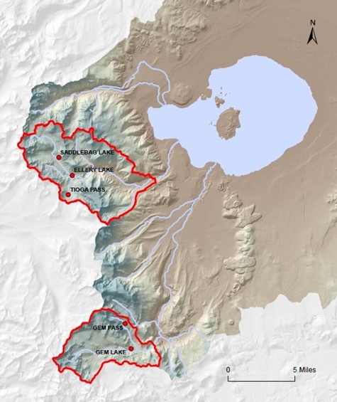
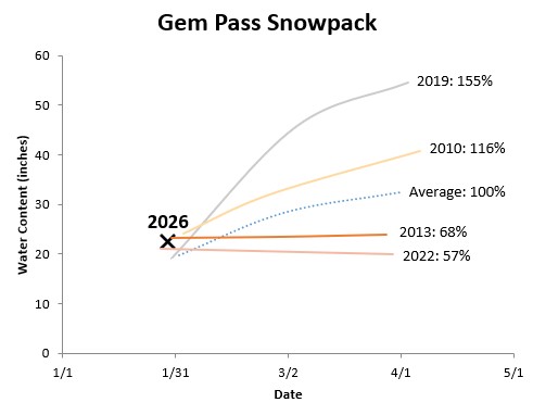
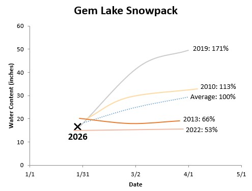
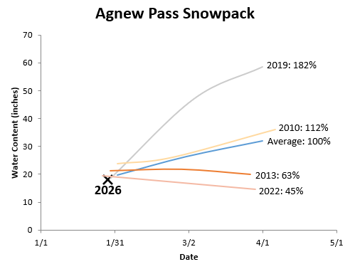
Southern California Edison conducted “February 1st” snow surveys in the Rush Creek watershed on January 28–29 and in the Lee Vining Creek watershed on January 27. The Rush Creek snowpack is surveyed at 10,750-foot Gem Pass, the highest elevation data point for California snowpack north of the San Joaquin River watershed, as well as at 9,150-foot Gem Lake. Surveys at 9,450-foot Agnew Pass are not typically used in Mono Basin runoff calculations but that location straddles the San Joaquin River–Rush Creek divide and provides part of the Rush Creek picture. Rush Creek snowpack at those three locations averaged 110%, 88%, and 91% of average, respectively.
These snowpack values close to 100% of average are encouraging hope that Rush Creek runoff could be close to average in the 2026 runoff year, however a look at past years shows this outcome isn’t guaranteed. The following three graphs show years with similar snowpack on February 1st, but with a wide range of different April 1st outcomes. A wet winter like 2019, while possible, is extremely unlikely based on global circulation, ocean conditions, and long-range weather forecasts. A winter like 2010 would result in near-average snowfall in February and March and slightly above-average April 1st snow water content, but this outcome is already looking less-likely this year. This leaves the likely path for 2026 somewhere between average and the bottom two lines on the graphs, which are the years 2013 and 2022. Those two years had similar February 1st snowpack as 2026, but ended up very dry in February and March with a declining snowpack.
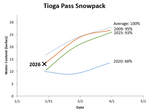
Lee Vining Creek snow surveys are a bit less optimistic. Last week’s surveys at 9,800-foot Tioga Pass, 9,750-foot Saddlebag Lake, and 9,600-foot Ellery Lake averaged 73%, 58%, and 79%, respectively. In the Central Sierra basins there is a strong north-south and elevational gradient in this year’s snowpack, with more snow to the south and at higher elevations.
Similar years for Lee Vining Creek February 1st snowpack shift to the drier end of the spectrum compared to Rush Creek. Tioga Pass snowpack is similar to 2009, while 2025 (last year) provides a slightly lower analogue and 2020 a much drier possibility. These years with similar February 1st snowpack actually aren’t quite as extreme as the wet/dry analogues for Rush Creek, but extreme dryness could still happen as the 2020 line shows.
What does all this mean for Mono Lake? Unless some big winter storms turn things around (a stormy pattern might return this weekend), it is starting to look like a relatively dry year. Mono Lake’s level will drop, and if DWP continues diverting water, the lake will remain in a range of levels that are dangerous for the ecosystem, and will drop even farther from its intended trajectory towards the healthy management level of 6,392 feet above sea level.
Top photo by Hannah Ashby: A snowy Mt. Wood reflects sunrise through the poconip fog on January 19, 2026.